Advanced use of GIS
- Data Quality Control
- Map production
- Publish map to WWW
- Publish map by email
- Compute data for our custumers
- Other small GIS applications
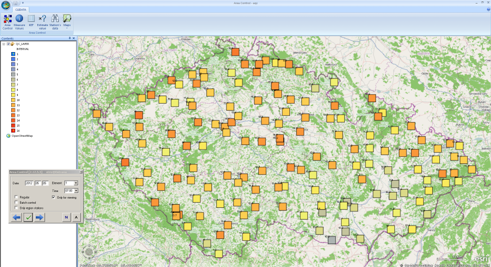
Data Quality Control
Clidata GIS Area Control
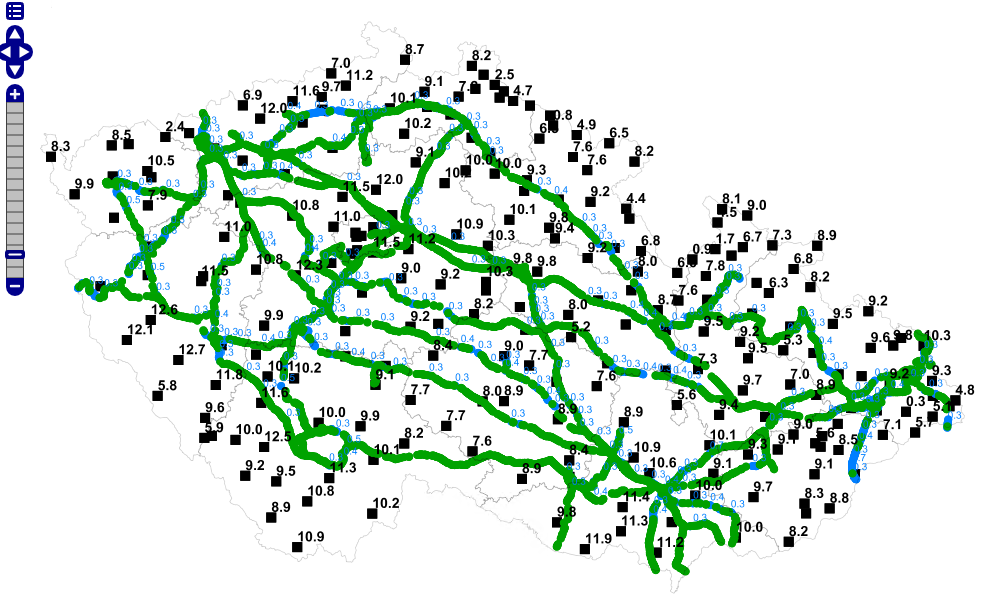
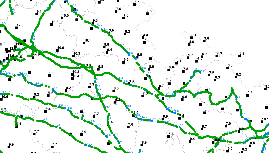
Map production
- regular create map report
- using GIS in Czech and international projects
- Clima Atlas of Czechia
More than 95% of maps was calculated by Clidata GIS application

map example: Average date of first snow

Publish map to WWW
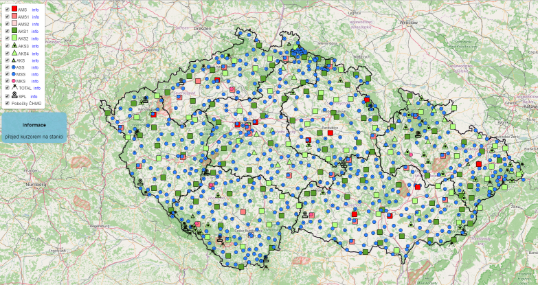
- publish metadata of meteorological data http://portal.chmi.cz/files/portal/docs/poboc/OS/stanice/ShowStations_CZ.html
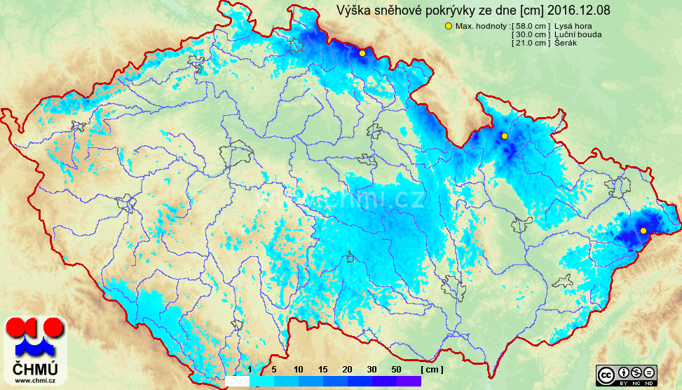
- generate 1H,1D,1M maps from selected elements http://portal.chmi.cz/files/portal/docs/poboc/OS/OMK/mapy/prohlizec.html
AirTemperature [XX:00,AVG,MIN,MAX,M:AVG]
XX:00 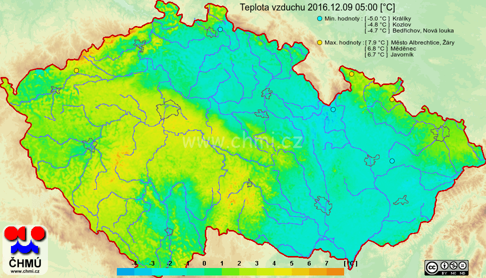
AVG 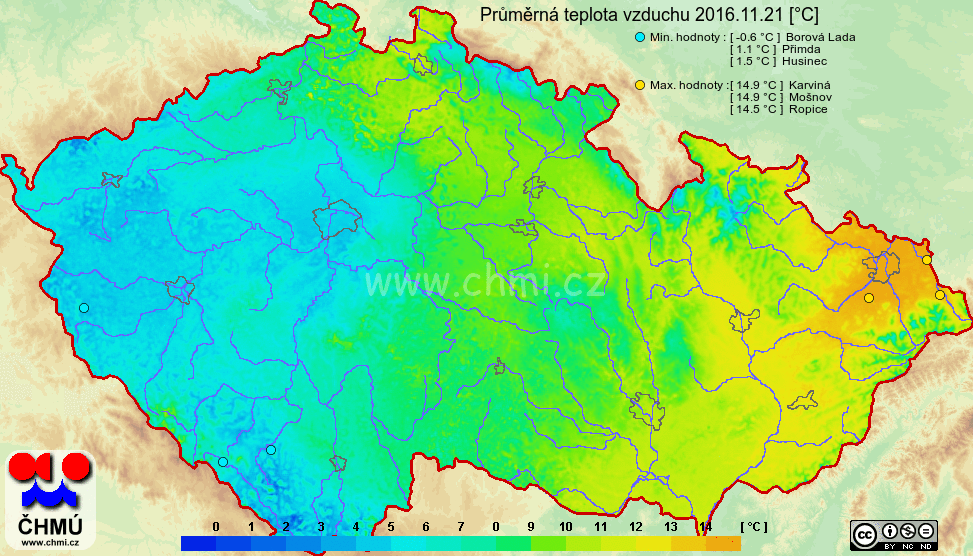
MIN 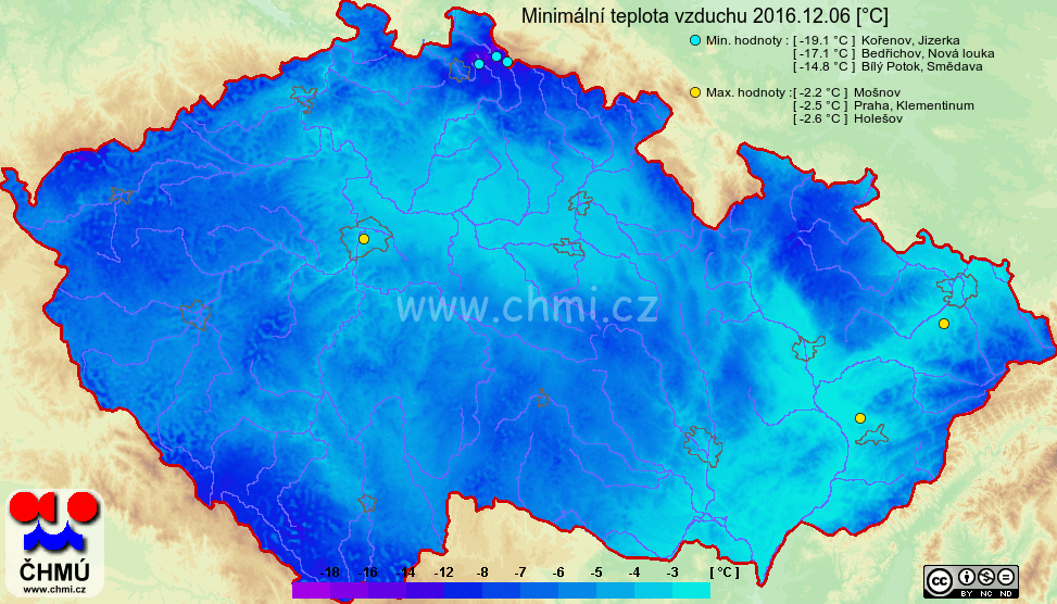
MAX 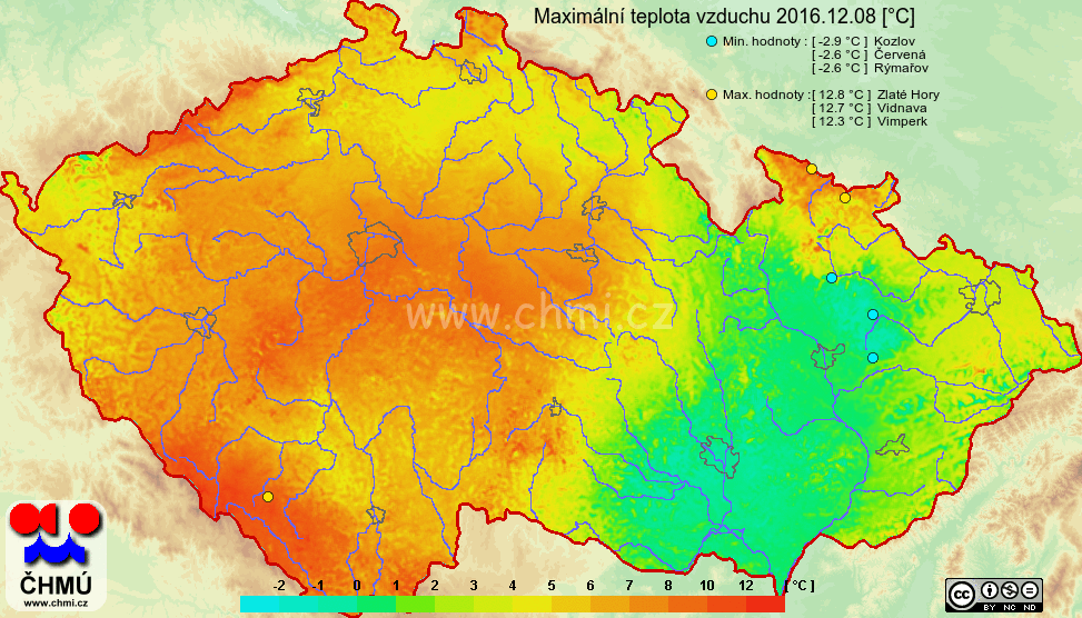
M - AVG 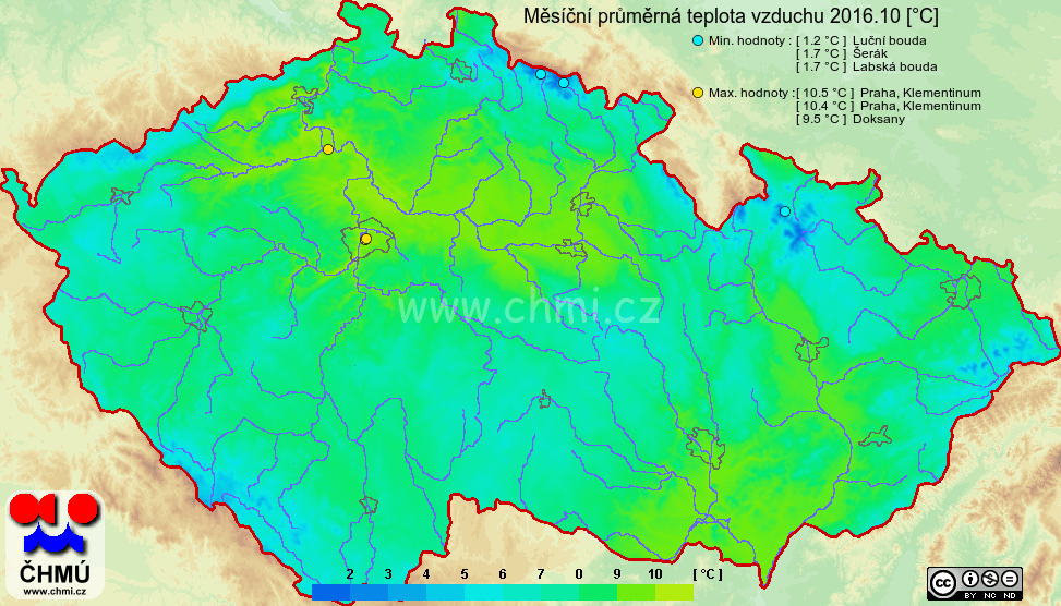
Precipication [XX:00,SUM,M:SUM]
XX:00 
SUM 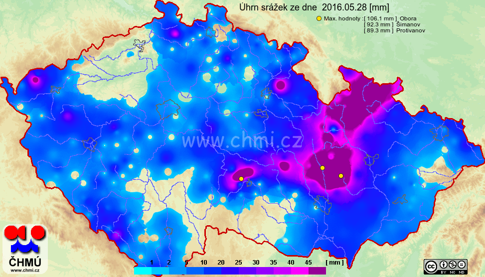
M - SUM 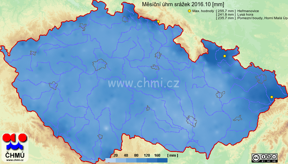
Snow cover [D]
New snow cover [D]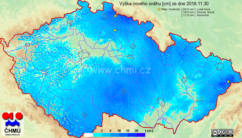
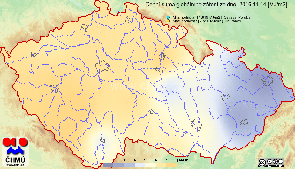
Global radiation
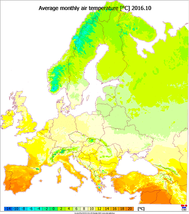
CLIMAT message map generator
We have imported CLIMAT message data into CLIDATA. From imported data we creating each month map and publish on WWW
http://portal.chmi.cz/files/portal/docs/poboc/OS/OMK/ClimatMapWeb/prohlizec.html
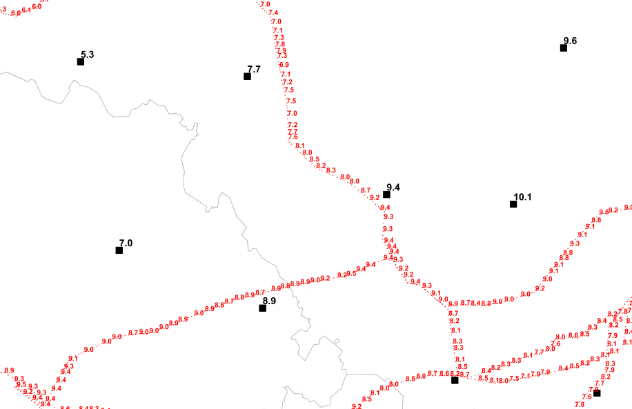
Online climaatological data for civil engineer
Civil Engineers need for correct dimension of roofs know long time period data like snow load data etc.
Project for Czech Republic

Project for Bosna and Hercegovina
http://www.bih.clima-maps.info/

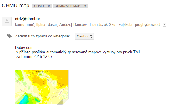
Publish map by email
Regulary sending interpolated map as attached file by email.
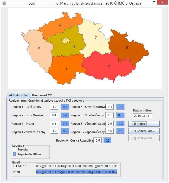
Compute data for our custumers
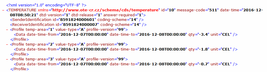
OTE
National electrocity and gas distribution regulator. Calculte 3 times per day area statistics of air temperature in OTE defined regions. For GAS only for area up to 700 m.s.l and ELECTROCITY without altitute limits. For each regions we generate XML file and send by FTP and by email.
example of XML file
CEPS
For another electrocity company we each hour estinate for each electrocity pylon defined on company's FTP server air temperature (it's about 20 000 pylons). Final interpolated air temperatures on each pylon we send as text file by out customer by FTP
Other small GIS applications
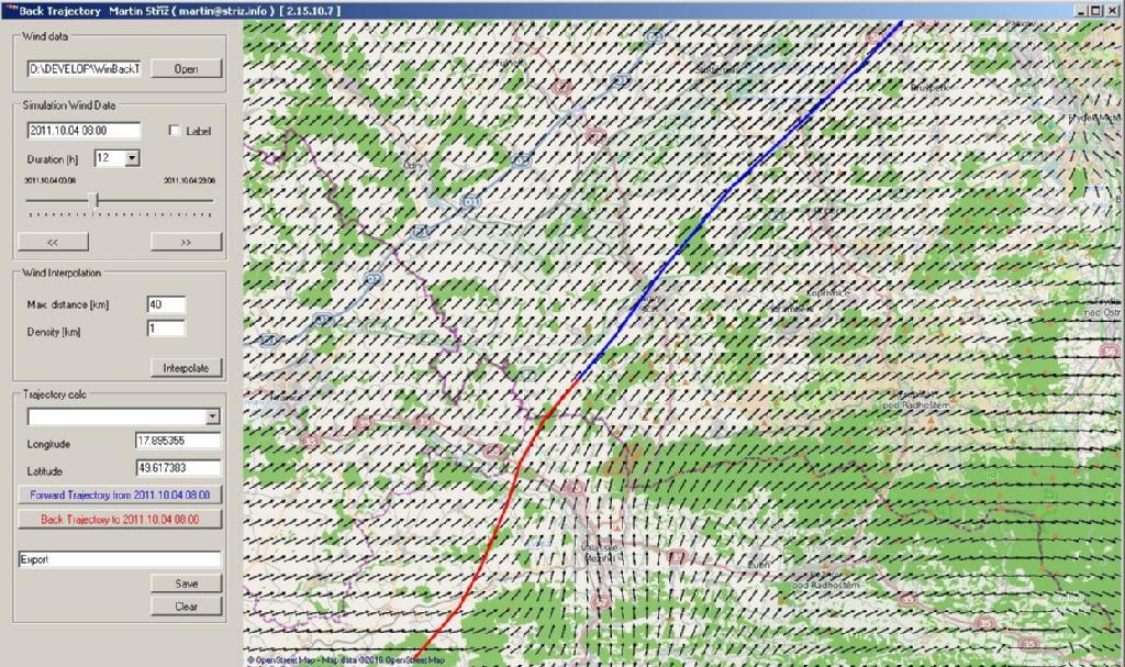
Wind Back Trajectory
Using Wind speed and wind director data from CLIDATA we calculate Air Flow Trajectory in given datetime period. Application uses mainly in department of Air Polution for search sources of air polutions.